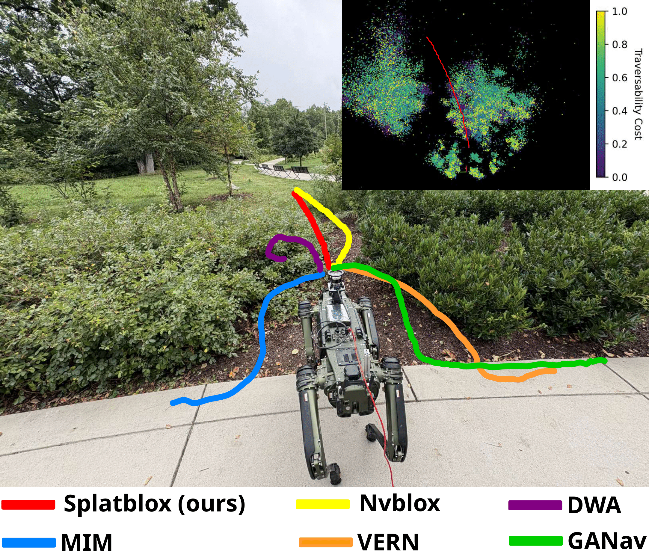
We present Splatblox, a real-time system for autonomous navigation in outdoor environments with dense vegetation, irregular obstacles, and complex terrain. Our method fuses segmented RGB images and LiDAR point clouds using Gaussian Splatting to construct a traversability-aware Euclidean Signed Distance Field (ESDF) that jointly encodes geometry and semantics. Updated online, this field enables semantic reasoning to distinguish traversable vegetation (e.g., tall grass) from rigid obstacles (e.g., trees), while LiDAR ensures 360° geometric coverage for extended planning horizons. We validate Splatblox on a quadruped robot and demonstrate transfer to a wheeled platform. In field trials across vegetation-rich scenarios, it outperforms state-of-the-art methods with over 50% higher success rate, 40% fewer freezing incidents, 5% shorter paths, and up to 13% faster time to goal, while supporting long-range missions up to 100 m.